The RGV has a variety of mountain bike trails and asphalt pump tracks that span along the U.S.-Mexico border. They range from the flat switchbacks of Brownsville’s Monte Bella, a fast trail under a lush canopy of mesquite trees and challenging features in the canal spillway that surrounds it, to the Harlingen Arroyo Trails, which have rolling mixed terrain that maximizes the limited elevation along the river embankment of the Arroyo Colorado. Harlingen Arroyo Park is also host to the RGV’s first asphalt pump track, built by American Ramp Company, and is a Velosolutions-branded track. Mission Trails offers the longest ride of the RGV trails, clocking in at just over 14 miles of singletrack, with cactus around every corner. The Edinburg Doolittle Nature Park and Trails offer a short but punchy variety of rollers and trail features such as jumps and drops. The new Brownsville Pedro “Pete” Benavides Park has the best of both worlds – a short but fun 3-mile mountain bike trail, and the brand new Alliance asphalt pump track, the first from this world-renowned bike park company in North America!
Mountain Bike Trails
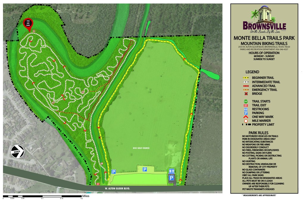
Brownsville Monte Bella Hike & Bike Trails
Address: 2525 W Alton Gloor Blvd., Brownsville, Texas 78520
Approximate Distance: 5.2 miles (perimeter trail and interior trail)
Trail Type: Multi-Use (mountain bike, trail runners, dog walkers, frisbee golf)
Difficulty Level: Mostly a green (easy) trail, with the only blue (intermediate) section in the canal that surrounds the perimeter loop. One single black (advanced) wood ramp and drop along the perimeter trail. 


Bike Rider Infrastructure: Restrooms, parking, bike repair station (1), trail markers indicating direction, difficulty and access to emergency access trail
Land Owner: City of Brownsville/City of Brownsville Parks and Recreation Department
Website: https://www.cob.us/Facilities/Facility/Details/Monte-Bella-Park-36
Harlingen Arroyo Hike and Bike Trails
Address: 1101 E. New Hampshire Street, Harlingen, Texas 78550
Approximate Distance: 5.1 miles (Henry Roberts Loop and The Thicket)
Trail Type: Multi-Use (mountain bike, trail runners, dog walkers, bird watchers)
Difficulty Level: The Harlingen Arroyo Hike and Bike Trails consist of five areas – Henry Roberts Loop (approx. 2.5 miles), Recluse (approx. 1 mile), Six Shooter Junction (approx. 1 mile), C.B. Woods (approx. 1 mile), The Dragonback (approx. 1 mile) and The Thicket (approx. 2.6 miles). All areas are connected by the Arroyo Hike and Bike paved trail, which itself connects Arroyo Park, McKelvey Park, C.B. Woods Park, and Dixieland Park in the heart of the city of Harlingen. The trail is mostly green (easy), with several blue (intermediate) trail features such as drops, jumps, steep climbs and skinny wood bridges. One section of Henry Roberts Loop, called “The Hub”, is being developed as a MTB skills section, with several options to ride green, blue, and eventually single black jumps.
Bike Rider Infrastructure: Restrooms, parking lot, trail markers indicating direction and difficulty
Land Owner: City of Harlingen/Harlingen Parks and Recreation Department
Website: http://www.myharlingen.us/page/parksandrec.parks

Map courtesy of VORBA Member, Everett Castellano
Mission Trails
Address: 1414 S. Conway Avenue, Mission, Texas 78572 (Google Map “Mission Hike and Bike Trails”)
Approximate Distance: 14 miles
Trail Type: Multi-Use (mountain bike, trail runners, dog walkers)
Difficulty Level: Mostly a green (easy) trail, with some blue (intermediate) sections after the cattle guard. Watch out for cactus!
Bike Rider Infrastructure: restrooms, parking lot, covered area, trail markers indicating direction and difficulty
Land Owner: City of Mission/Mission Parks and Recreation Department
Website: https://missiontexas.us/city-departments/parks-and-recreation/city-parks/
Mission Trails map coming soon!
Edinburg Doolittle Nature Park and Trails
Address: 1300 N. Doolittle Rd., Edinburg, TX 78541
Approximate Distance: 3 miles
Trail Type: Multi-Use (mountain bike, hiking, trail running)
Difficulty Level: It might be short in distance, but it is mighty challenging for mountain bikers of all skill levels. The Edinburg Doolittle Trails consist of two 1.5-mile sections, each with alternate pathways and its share of challenges – from fun rollers, small jumps, and some intermediate-level drops.
Bike Rider Infrastructure: Parking, portable restrooms, and covered areas
Land Owner: City of Edinburg Parks and Recreation
Website: https://cityofedinburg.com/departments/parks_and_recreation/parks___recreation_home.php
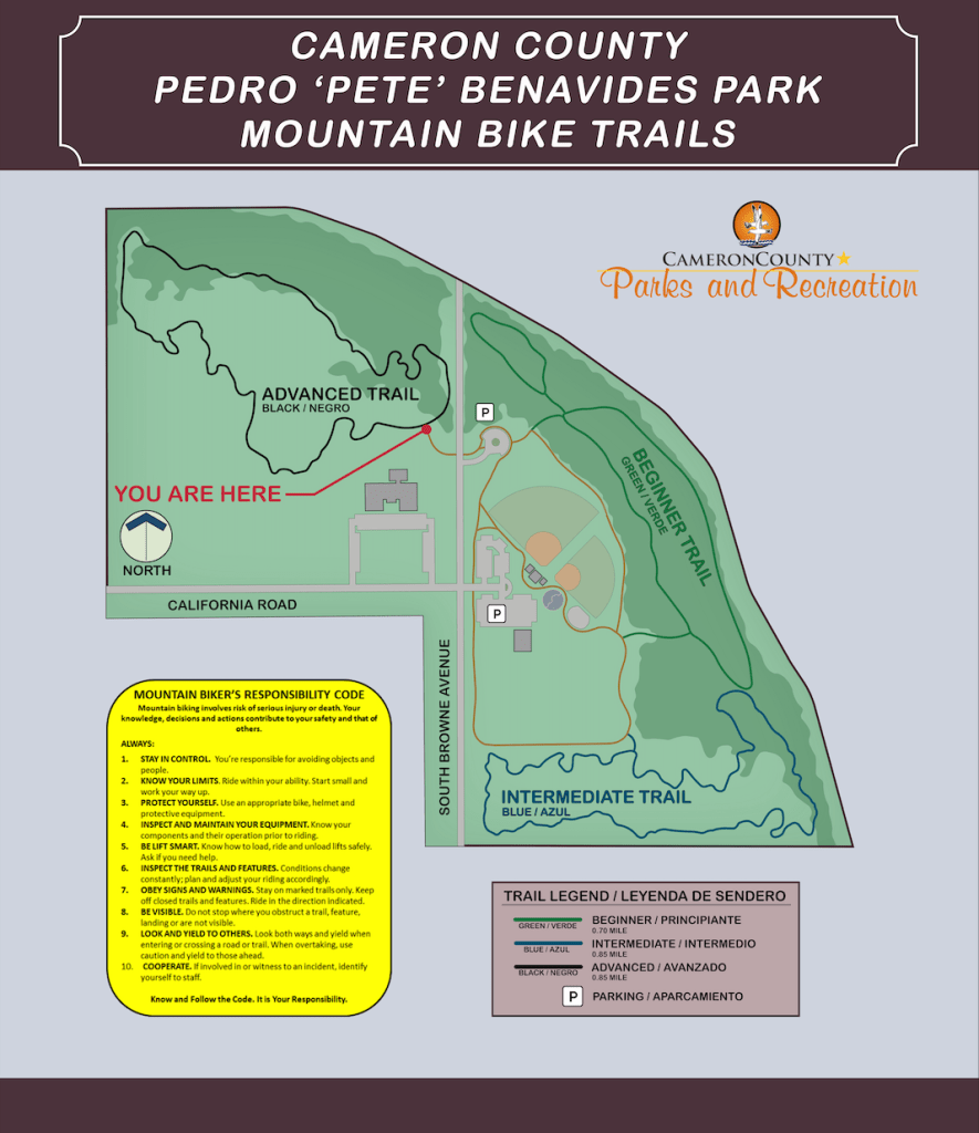
Benavides MTB Trails (Brownsville, Texas)
Address: 2055 S. Browne Road, Brownsville, TX 78521
Approximate Distance: 3.2 miles
Trail Type: Multi-Use (mountain bike, trail running, walking)
Difficulty Level: The newest trail system in the RGV, Benavides MTB Trails are mostly green (easy) trails, although they are marked intermediate in some areas (see map). Most of the trail is wide trail (not singletrack), with some fun turns. The “intermediate trails” have some fun wood features (wall ride, bridge), with small little jumper ramps dotted along the trails for some diversions on your ride. There are two areas designated for a dirt pump track, but needs some work. Tons of potential here!
Bike Rider Infrastructure: Parking, restrooms, playground area, walking track, trails are well-marked, and lighting for evening hours
Land Owner: Cameron County Parks & Recreation
Website: https://www.cameroncountytx.gov/parks-community-parks/parks-pete-benavides/
ASPHALT PUMP TRACKS
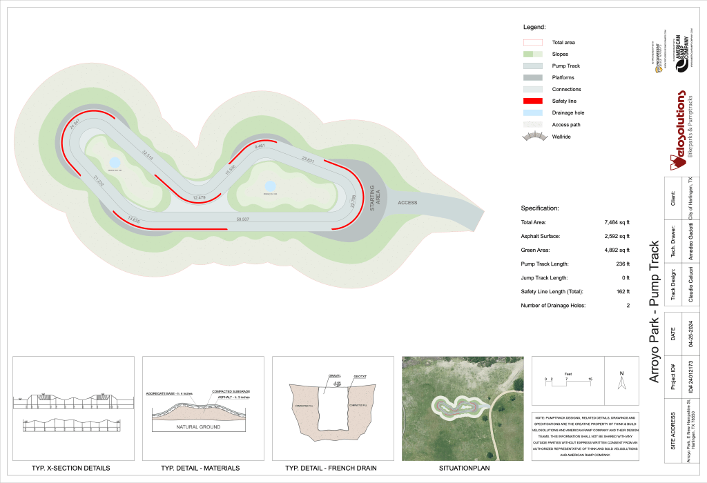
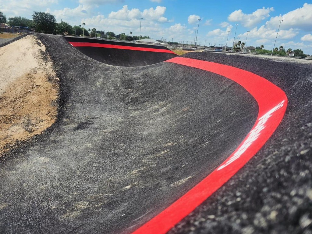
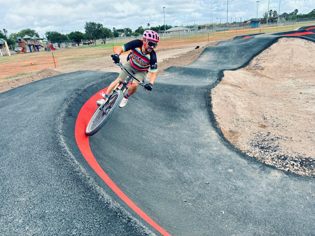
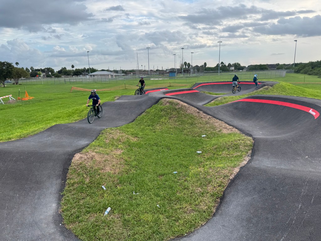
Harlingen Arroyo Park – Velosolutions Pump Track
Address: 1101 E. New Hampshire St., Harlingen, TX 78550
Approximate Length of Track/Total Area: 71 meters (695 total area)
Track Type: Velosolutions Pump Track
Surface Type: Asphalt
Contractor: American Ramp Company
Bike Rider Infrastructure: Parking, Restrooms, Seating
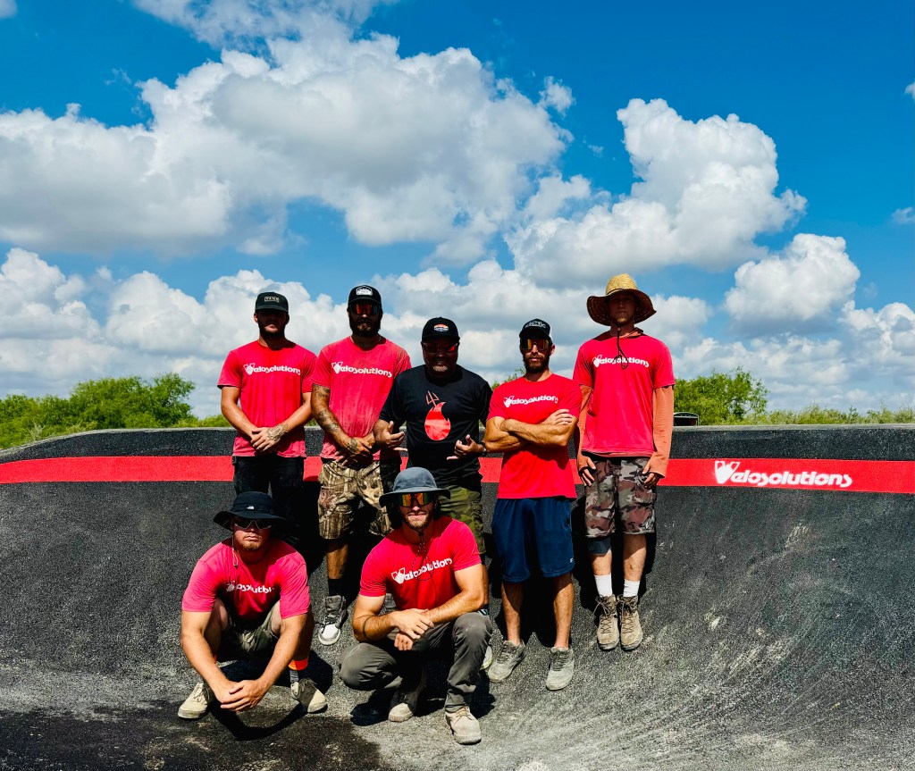
Description: The Harlingen Arroyo Park/Velosolutions pump track was built in June 2024, and is the first Velosolutions asphalt pump track built in the Rio Grande Valley, and the only track south of Sugar Land and San Antonio.
Land Owner: City of Harlingen Parks and Recreation


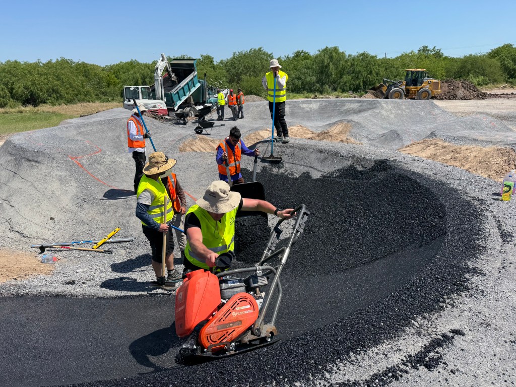
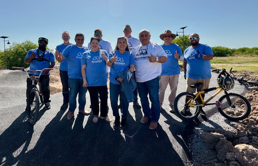
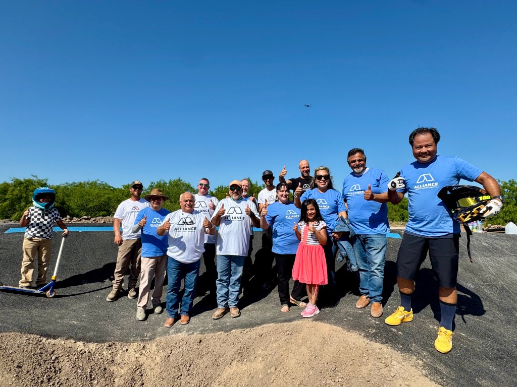
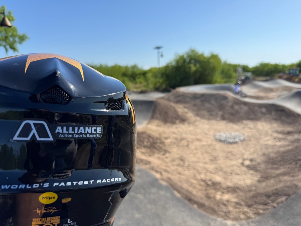
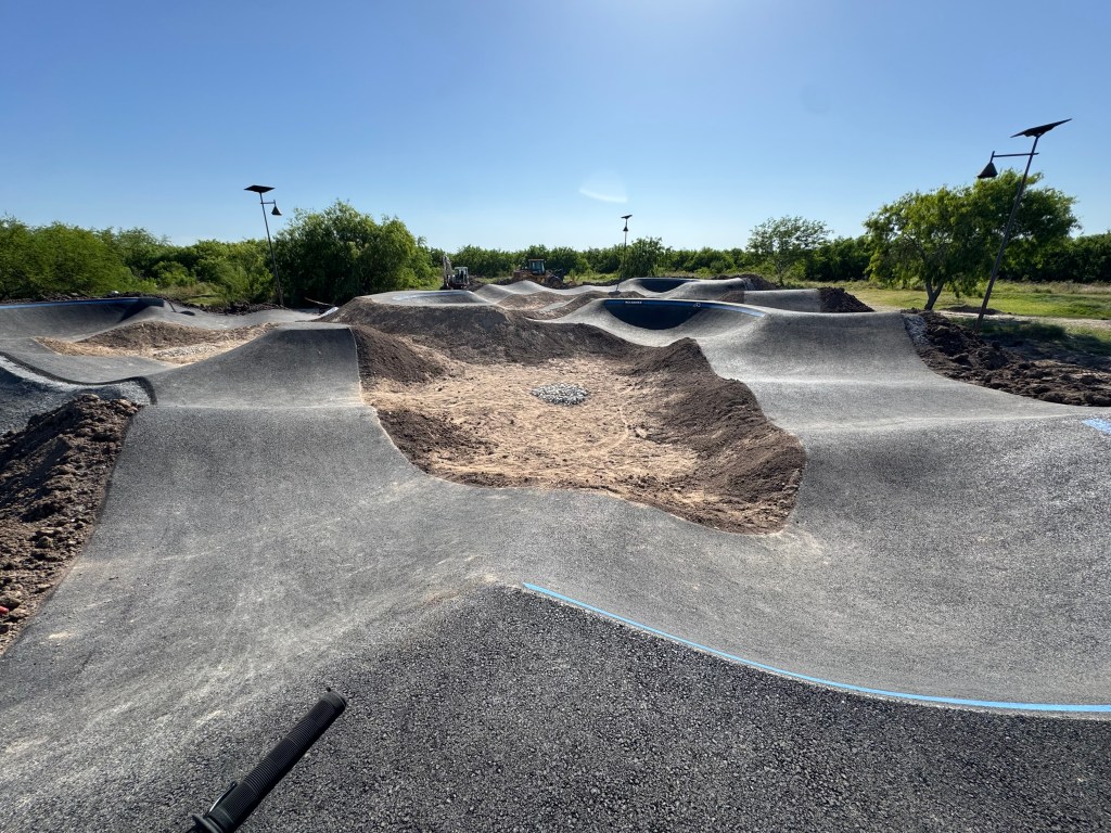
Brownsville Pedro “Pete” Benavides Park Pump Track
Address: 2055 S. Browne Rd., Brownsville, Texas 78521
Approximate Length of Track/Total Area: 492 linear feet of asphalt track (4,695 t total area)
Track Type: Alliance ASE Pump Track

Surface Type: Asphalt
Contractor: Alliance ASE North America
Bike Rider Infrastructure: Parking, Restrooms, Covered area, Seating, Solar Lighting
Website: https://www.cameroncountytx.gov/parks-community-parks/parks-pete-benavides/
Description: The Pedro “Pete” Benavides / Alliance Pump Track was built in March 2025 by Alliance ASE, a world-renowned action sports park builder based in Europe. This project was funded by Cameron County Parks and Recreation as part of their newly renovated Pedro “Pete” Benavides Park in the deep southeastern part of Brownsville, Texas. The park features mountain bike trails, a running track, pickleball courts, a covered basketball court area, playgrounds, and now an asphalt pump track. This is Alliance ASE’s first asphalt pump track in North America, and it has a variety of rollers, berms, and a dedicated jump line for riders of all skill levels.
Land Owner: Cameron County Parks and Recreation